


Yuma 1, Yuma County, Colorado
About
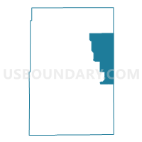
Outline

Summary
| Unique Area Identifier | 549422 |
| Name | Yuma 1 |
| County | Yuma County |
| State | Colorado |
| Area (square miles) | 190.25 |
| Land Area (square miles) | 189.97 |
| Water Area (square miles) | 0.29 |
| % of Land Area | 99.85 |
| % of Water Area | 0.15 |
| Latitude of the Internal Point | 40.14747850 |
| Longtitude of the Internal Point | -102.14245760 |
Maps


Graphs
Select a template below for downloading or customizing gragh for Yuma 1, Yuma County, Colorado


Neighbors
Neighoring Voting District (by Name) Neighboring Voting District on the Map
- District 3, Dundy County, NE
- Wano 1 Township Voting District, Cheyenne County, KS
- Yuma 12, Yuma County, CO
- Yuma 2, Yuma County, CO
- Yuma 7, Yuma County, CO
- Yuma 8, Yuma County, CO
Top 10 Neighboring County Subdivision (by Population) Neighboring County Subdivision on the Map
- Wray CCD, Yuma County, CO (4,088)
- Wano township, Cheyenne County, KS (1,839)
- Idalia-Joes CCD, Yuma County, CO (951)
- Haigler precinct, Dundy County, NE (292)
Top 10 Neighboring Place (by Population) Neighboring Place on the Map
Top 10 Neighboring Unified School District (by Population) Neighboring Unified School District on the Map
- Wray School District RD-2, CO (3,958)
- Dundy County Public Schools, NE (2,501)
- St. Francis Community Schools Unified School District 297, KS (2,016)
Top 10 Neighboring State Legislative District Lower Chamber (by Population) Neighboring State Legislative District Lower Chamber on the Map
Top 10 Neighboring State Legislative District Upper Chamber (by Population) Neighboring State Legislative District Upper Chamber on the Map
- State Senate District 1, CO (125,154)
- State Senate District 40, KS (61,332)
- State Senate District 44, NE (33,011)
Top 10 Neighboring 111th Congressional District (by Population) Neighboring 111th Congressional District on the Map
- Congressional District 4, CO (725,041)
- Congressional District 1, KS (655,310)
- Congressional District 3, NE (561,378)
Top 10 Neighboring Census Tract (by Population) Neighboring Census Tract on the Map
- Census Tract 9631, Yuma County, CO (4,602)
- Census Tract 9502, Cheyenne County, KS (2,726)
- Census Tract 9623, Dundy County, NE (2,008)